How to get a "public
domain" street map of an address
in the
“Public domain” means there
is no Copyright © on the image and you can use it in your web page without
written permission from a Copyright owner.
Go to the Terra Server
advanced find http://terraserver-usa.com/address.aspx courtesy of the U.S.
Geological Survey and several
Enter the complete address
and click Go
Click on the “Aerial Photo”
link. If there is no “Aerial Photo” link
then this process can’t continue.
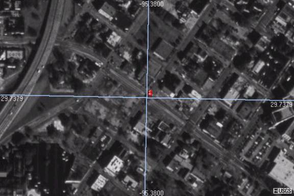
You should see an overhead
view of the area where the address is.
Click on the 'Info' link at
the top ![]()
The image on this page will
have the approximate latitude and longitude of the address.
Longitude
Latitude
Copy the latitude and
longitude into the Tiger Map Server Browser
http://tiger.census.gov/cgi-bin/mapsurfer http://tigerweb.geo.census.gov/tigerweb
(Updated
Set the Map Width and Height
to .008 to start and click the Redraw Map button. You can reset the map dimensions later for
better readability.
Use the Place Marker option
to put a crosshairs symbol and label where the group or club is located. The input boxes to select the symbol to use
and add the label are down near where you entered the latitude and longitude.
Click ON THE IMAGE to:
Zoom
in, factor:
Zoom
out, factor:
![]() Move to
new center
Move to
new center
Place
Marker (select symbol below)
Download
GIF image
You might want to look up
the address in Mapquest, http://www.mapquest.com/,
to see exactly where to put the symbol.
Right click on the image and
save it to your hard drive.
Don’t say the gubmint never gave you nothing!